
MENÚ UNIDAD
ARMY UNITS
- Araba Álava |
- Albacete |
- Alicante |
- Almería |
- Asturias |
- Ávila |
- Badajoz |
- Barcelona |
- Burgos |
- Cáceres |
- Cádiz |
- Cantabria |
- Castellón |
- Ceuta |
- Ciudad Real |
- Córdoba |
- A Coruña |
- Cuenca |
- Girona |
- Granada |
- Guadalajara |
- Gipuzkoa |
- Huelva |
- Huesca |
- Islas Baleares |
- Jaén |
- León |
- Lleida |
- Lugo |
- Madrid |
- Málaga |
- Melilla |
- Murcia |
- Navarra |
- Ourense |
- Palencia |
- Las Palmas |
- Pontevedra |
- La Rioja |
- Salamanca |
- Segovia |
- Sevilla |
- Soria |
- Tarragona |
- Santa Cruz de Tenerife |
- Teruel |
- Toledo |
- Valencia |
- Valladolid |
- Bizkaia |
- Zamora |
- Zaragoza
Background
- pagination
-
BRIEF HISTORY OF CENTRO GEOGRÁFICO DEL EJÉRCITO
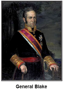
The background of the Army Geographical Center dates back to 1810 when, in the midst of the War of Independence, Lieutenant General Blake studied and proposed the creation of the General Staff Corps, which in its founding document was assigned the mission, among others, of drawing maps, copies and reproductions of them, as well as establishing a Depository to store all the plans, sketches, geographical descriptions, etc.
Organized in four sections, two of them—the second and the fourth—were in charge of these tasks: creation and archiving of cartographic documents. These two sections can be considered the germ of what today is the Geographical Center.
That embryonic Geographical Center suffered the same vicissitudes as the Corps to which it belonged, being dissolved in 1814 and 1824 and reactivated in 1823 and 1836, until, finally, in 1838 the War Depository was created as an independent body attached to the General Directorate of the Staff Corps.
In 1842 the Army War College was created, where a group of highly qualified chiefs and officers were trained in the study of geodesy and cartography.
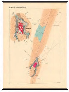
Topographic Itinerary (1848)
In 1847 the regulations of the Depository were approved, which divided it into two sections, one of geography and topography and the other of military history and statistics.
In 1853 the Commission of the Geographic Chart of Spain was created, composed by officers of Artillery, Engineers and General Staff, with the objective of carrying out the geodetic and topographic surveying and to conduct the necessary cartographic operations to draw the national topographic map.
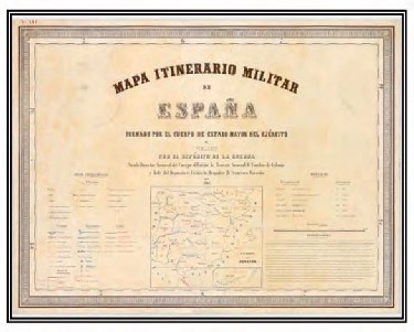
Cover of the military itinerary map
In 1865 the Depository published the Military Itinerary Map of Spain, at a scale of 1:500,000, only planimetrical, considered the first official map of the country.
In 1867 the publication of the Military Descriptive Itinerary of Spain, in eight volumes, which had begun a year earlier, was completed.
In 1870 the Geographical and Statistical Institute—currently the National Geographical Institute—was founded, whose initial staff was formed by the members of the commission of the Geographic Chart and which, from then on, would be in charge of drawing the national map at a scale of 1:50,000. In that same year, the regulations, ordinances and other provisions of the Ministry of War began to be printed at the Depository.
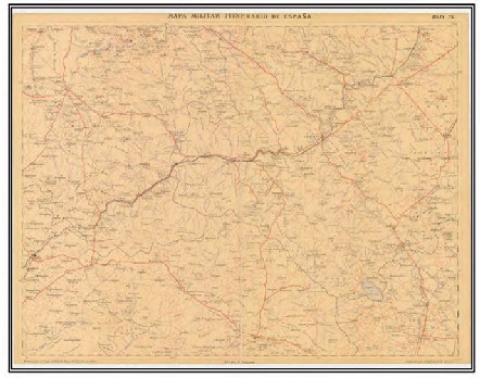
Military itinerary map of Spain (1889-1944). Scale 1:200.000
In 1881 the Instructions for the topographical and statistical works entrusted to the Staff Corps were promulgated, which included drawing up an itinerary military map of Spain at a scale of 1:200,000, surveying population plans, battlefields and camps, and carrying out the reconnaissance of frontiers.
In 1882 the Geographical Commission of Morocco was created, in charge of the study of that country. That same year the creation of the military map of Spain was undertaken by a commission of chiefs created for that purpose, as well as the demarcation of the Spanish-Portuguese border.
1886 marks the year of the creation of the Staff Topography and Works Brigade, which affects the War Depository. Its personnel are assigned the missions of rendering their services in the aforementioned Depository, in the topographical commissions of the Staff Corps and in the Staffs of the Operations Armies.
In 1912 the new technical Instructions for the geodesic and topographic works of the General Staff Corps were promulgated, which regulated the performance of the Geographical Commissions, beginning that year the creation of the military map of Spain to scale 1:100,000.
Minute of the national map (1928). War Depot
In 1923, in order to intensify the work on the National Map at a scale of 1:50,000, the War Depository lent its collaboration to the Geographical and Cadastral Institute. This first collaboration lasted until the year 1931, and in eight years the Depository surveyed and calculated and drew up 51 sheets of that map, leaving ten more almost finished.
Photogrammetry burst with great momentum in the twenties, being the Depository a pioneer in this technique when it acquired in 1923 a Von Orel-Zeiss stereoautograph, phototeodolites, etc., which it applied initially to surveying rugged areas, such as the Pyrenees, Guadarrama and the Canary Islands. But it is in Morocco where the new method is contrasted in all its value, restoring areas of the insurgent camp under enemy fire in the bay of Al Hoceima.
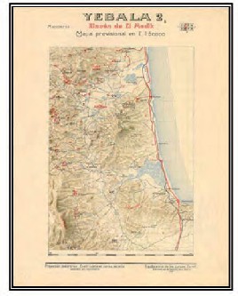
Morocco Protectorate Map (1923-1940)
During these works the first casualties of the Works Brigade took place, and as a reward for its outstanding services, loyalty, discipline, blood sacrifice and courage during the Moroccan campaign, in 1926 it was granted the honor of guarding the national flag, which was delivered with all solemnity before the King and Queen of Spain.
Once the pacification of the Protectorate was finished in 1927, the partial surveys of all types were gathered, their characteristics were unified, what was missing was completed and in six months the complete provisional map of the territory was published on a scale of 1:200,000.
Immediately afterwards, the regular drawing of the same map began at a scale of 1:50,000, concluding its publication in 1934.
When the Second Republic was proclaimed, the War Depository was suppressed in 1931, ceasing its collaboration with the Geographical Institute. In its place, a cartographic branch was created in the Central Staff and another for liaison with the Institute, while the Geographical Commission of Morocco and those in charge of limits with neighboring States remained. In 1933 the Works and Topographic Brigade was disbanded.
That same year a Regulation of Military Cartography was promulgated that established the creation of six series of maps and plans of all Spain at a scale from 1:10,000 to 1:500,000, which should be obtained from the national map, of which, at that time, not even half of the sheets had been published.
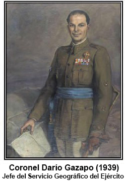
After the war, the law of September 22, 1939, which reorganized the Ministry of the Army, created a Geographical and Cartographic Service of the Army that inherited the missions of the former Depository, except for the historical ones, which were gathered in another independent Service. Its first director would be Infantry Colonel Darío Gazapo Valdés.
The new organization would face an overwhelming task. On the one hand, it had to comply with all the provisions of the Military Cartography Regulations of 1933. On the other hand, considering that both national defense and the reconstruction and development of the country required the prompt availability of the national map at 1:50,000 scale, the collaboration of the Service with the Geographical Institute was reestablished in 1941 until the definitive conclusion of the map in 1966. The Service drew up 168 sheets of that map, including triangulation, geometric leveling, detailed survey, calculation and drawing of the minutes at 1:25,000 scale, which were delivered to the Institute for its publication at “fifty thousand”.
Additionally, the Service was ordered to carry out the regular survey of our territories, protectorates and colonies of West Africa and the Gulf of Guinea, of which only rudimentary maps without any scientific nature existed at that time.
To satisfy the new needs and requirements, the School of Geodesy and Topography of the Army was founded in 1941.
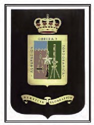
Coat of Arms of the Agrupación Obrera y Topográfica
With the same purpose, in 1944 the General Staff Works and Topographic Brigade—which in 1959 would be renamed Works and Topographic Group of the Geographical Service—was reorganized.
The Geographical Service did not remain on the sidelines of the growing development of geodetic-cartographic techniques and progressively and constantly modernized both its means and its procedures.
In 1966, the minutes for publishing the last sheet of the National Topographic Map were delivered to the Geographical Institute, the printing of the new Military Itinerary Map at 1:200,000 scale was completed, some 80 sheets of the Command Map at 1:100,000 scale, 1,750 sheets of the Director Map and numerous plans of firing and maneuvers ranges had been published; in addition, the Map of Spanish West Africa 1:500,000 and various maps of continental and insular Guinea were produced and published.
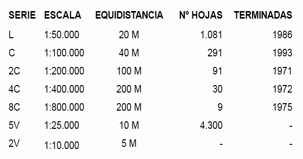
In 1968, the Geographical Service adopted the “Universal Transverse Mercator” (UTM) mapping system and its military grid, as well as the geodetic reference system known as “European Datum 1950”, once again taking the lead in the modernization of national cartography and undertaking the complete renovation of the Army maps. The new cartography covers a range of scales from “ten thousand” to “eight hundred thousand”, being the “fifty thousand”—or L series as it is traditionally known—the fundamental series. In addition to these series, the need to have a cartography that matched in scale and content with the NATO regulations made it necessary to produce the 5L series at a scale of 1:250,000.
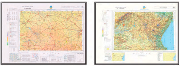
Serie 2C. E. 1:200.000 - Serie 8C. E. 1:800.000
In 1993, as a consequence of the progressive implementation of NATO’s cartographic policy and the need to have a geographical database, the creation of new series corresponding to the national territory began, at a scale of 1:50,000, using computer-assisted techniques in all the processes. It was in 1994 when the production of standardized NATO cartography of the rest of the scales used by the countries of the Alliance began.
In 1987-1988, the first austral campaign in which the Geographical Service took part was carried out, becoming an organization which produced cartography of Antarctica of interest for Spain.
In 1998, the traditional name of the Geographical Service was changed to the new Army Geographical Center (CEGET), as the central technical body responsible for the operational, logistical and technical aspects of geodesy, topography and publications.
In 2002, the Army Geographical Unit (UGET) was organized with the mission of providing on-site geographical support to units deployed in operations and exercises.
This new unit, formed with personnel specialized in geographic information and publications, constitutes a real mobile geographical center, capable of deploying in any area of operations and providing the necessary support to any unit in any scenario. This unit has been part of several NATO Response Force (NRF) actions and also contributes to the geographical capabilities of the Eurocorps.
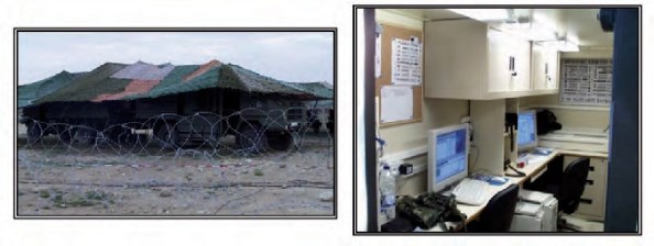
Deployment of Unidad Geográfica del Ejército (UGET)
As a result of the R+D+i work carried out at the Center and the experience obtained in the development and edition of digital cartography, since the year 2000 a geographic information system with military characteristics has been available, capable of being integrated into any information, simulation or weapons system of the Armed Forces.
Based on this and as a derivative product, the computer application called Digital Chart has been developed, which allows working with digital cartography and satellite images in multiple formats, integrating a database with information associated to the cartographic elements to perform complex analyses of the available information.
This software application has been developed year after year and can now be used on mobile platforms such as tablets and smartphones with Android operating systems.
The CEGET continues to provide information and geographical support in exercises and operations in the different areas of action of our units wherever required, and has participated on several occasions in the Lebanon and Afghanistan missions.
In 2014, on the occasion of the commemoration of the 75th anniversary of the creation of the CEGET, the Ministry of Foreign Affairs and Cooperation imposed on the flag of the Center the Cravat of the Order of Civil Merit, awarded in recognition of the work done by this Unit in support of the maintenance of the land borders with France and Portugal.
-
Vínculos

Mapa del sitio